What Is an Impervious Area (and Why It Matters in Site Planning)
In site planning and zoning, impervious coverage refers to the portion of a property covered by materials that do not allow water to pass through.
Put simply, an impervious area is a part of a lot that doesn’t absorb rainwater, leading to increased stormwater runoff and potential drainage issues. That’s why municipalities regulate maximum impervious coverage as part of zoning codes, often to prevent flooding, protect ecosystems, and manage infrastructure loads.
Whether you're designing a single-family lot or a multi-family development, impervious surface coverage directly affects:
- Stormwater strategy and detention requirements
- Site layout and open space
- Zoning compliance
- Potential yield and buildable area
Knowing your impervious area early helps you avoid costly redesigns later.
Impervious Area vs Impervious Coverage Definition
Impervious area is the total surface area on a site that prevents water infiltration into the ground. Impervious coverage (or lot coverage) is the percentage of the lot covered by impervious surfaces. Both are important metrics in zoning compliance and site planning.
Types of Impervious Surfaces
Impervious surfaces generally fall into two main categories:
Building Coverage:
These are structures that typically count toward building coverage in zoning terms:
- Buildings
- Garages
- Covered decks
- Covered porches
Site Coverage:
These contribute to impervious lot coverage, but aren't buildings:
- Parking lots
- Paved Walkway
- Paved Sidewalks
- Patios (if not pervious)
- Pools

Grass, landscaping, and pervious pavers typically do not count toward impervious coverage—though definitions may vary slightly by jurisdiction.
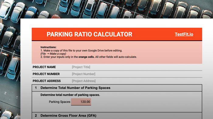
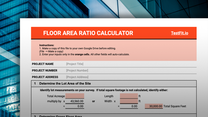
How to Calculate Impervious Coverage
To determine impervious lot coverage, you need to:
- Identify all impervious surfaces on the property
- Measure the area of each (length × width)
- Sum all impervious areas
- Divide by the total lot area
- Multiply by 100 to get a percentage
Impervious Area Calculation Formula:
Impervious Coverage (%) = (Total Impervious Area ÷ Lot Area) × 100
For example, if your impervious surfaces total 4,000 sq ft and your lot is 10,000 sq ft:
(4,000 ÷ 10,000) × 100 = 40% impervious coverage
Many zoning codes set a maximum impervious coverage limit, such as 50% of a residential lot. Exceeding that could trigger site redesigns or stormwater management requirements.
Automate Your Impervious Coverage Calculation with TestFit
The calculator is a great start—but when you're ready to generate site plans, analyze zoning constraints, and explore yield, a feasibility study platform like TestFit can take you further—and faster.
Automate Zoning Research with Built-In Data
Rather than flipping through dozens of pages to find out how much impervious coverage you're allowed, TestFit lets you access key zoning data instantly. That includes permitted land uses, maximum FAR, setbacks, and impervious coverage limits, and more—all baked into your design process.
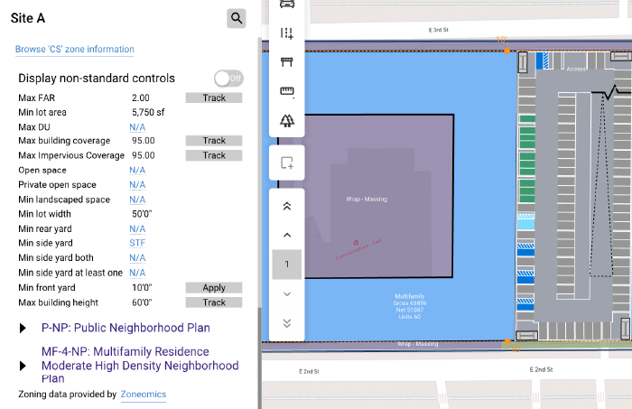
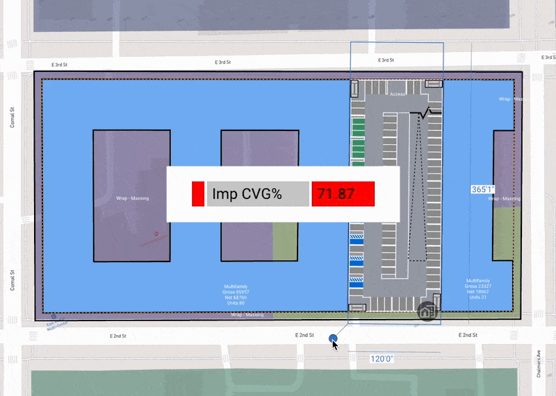
Visualize Zoning Compliance with Pass/Fail Score
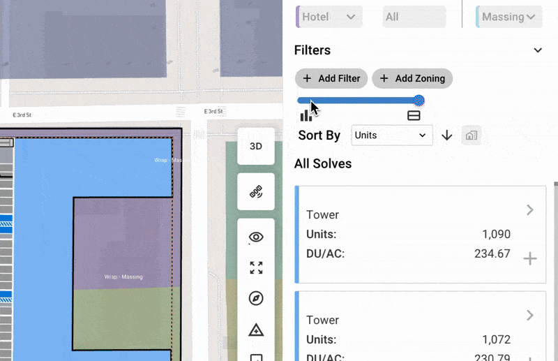
In TestFit, you can build a custom zoning profile and apply it directly to your design schemes. As you work, you'll get a visual pass/fail score based on your constraints, including building and impervious coverage. It’s an easy way to catch compliance issues early, without having to manually check each layout.
Optimize Impervious Coverage with Generative Design
Once you know your impervious coverage limit, the next challenge is designing something that works within it.
In TestFit, you can generate a range of design options based on max/min impervious coverage values that you set. Whether you're aiming to maximize yield, minimize footprint, or strike a balance between the two, TestFit helps you explore what’s possible in minutes, not hours.
.avif)