
Before the renderings. Before the modeling. Before the client presentation.
Architectural design begins with site analysis—a detailed understanding of where, what, and how you're allowed to build. Whether you're working on a single-family lot or a large-scale development, skipping site due diligence can lead to missed opportunities, busted budgets, or outright project failure.
What is Architectural Site Analysis?
Site analysis is the process of gathering and evaluating information about a physical location before beginning design. It’s how architects translate physical, environmental, regulatory, and contextual factors into design constraints and opportunities.
This includes data on:
- Legal boundaries and parcel ownership
- Zoning and entitlements
- Topography and soil conditions
- Utility access and environmental factors
- Local policies, overlays, and planning goals
We use site analysis to understand what’s possible—and what’s not—before laying down a single line of design.
Why Perform a Site Analysis?
Every site tells a different story. Site analysis lets you understand the story.
Here's what it helps you do:
- Avoid costly redesigns by aligning early with zoning and utility constraints
- Unlock development potential through incentives like density bonuses or TOD eligibility
- Plan realistic timelines by understanding permitting complexity
- Support the entitlement and permitting strategy with better documentation
- Create site-specific architecture that responds to environment and context
Put simply: a great site analysis turns risk into clarity.
Data Needed for Site Analysis
Effective site analysis includes multiple layers of data. Think of it like stacking maps:
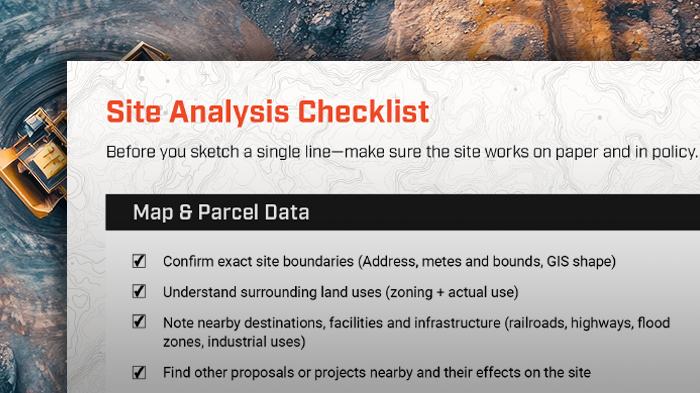
1 - Map & Parcel Data
We begin with map and parcel data to establish the foundation of what we’re working with. This includes legal boundaries, lot shape, and spatial context. Understanding the surrounding land uses and nearby developments helps anticipate potential conflicts—or opportunities for synergy—with neighboring properties.
.gif)
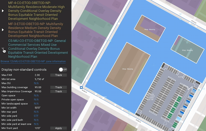
2 - Zoning & Policy Data
Next, we dig into zoning and policy data, which define what’s legally allowed on the site. Floor Area Ratio (FAR), setbacks, height limits, and parking minimums directly influence the envelope and program you can design. General Plan designations, overlays, and conditional uses further guide what kind of project is even feasible or permitted by right.
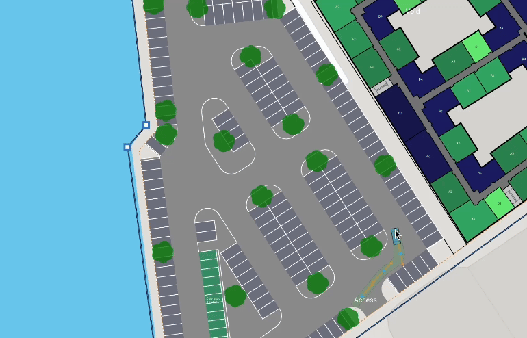
3 - Access & Circulation
Access and circulation data tell us how people—and vehicles—can interact with the site. From curb cuts and Right-of-Way (ROW) widths to proximity to transit lines, this layer affects everything from parking strategies to emergency access. A site that looks good on paper may still be unbuildable if fire trucks can’t turn around or there's no legal access point.
4 - Utilities & Infrastructure
Utilities and infrastructure data is crucial for determining project feasibility and cost. You need to know whether water, sewer, storm, electricity, gas, and telecom services are present—and if they have capacity for your intended use. Missing or undersized utilities can add major delays and expenses during development.

5 - Topography & Environmental Conditions
The topography and environmental conditions layer reveals physical and climatic constraints. Steep slopes, floodplains, soil instability, or seismic zones can all affect structural strategies, grading, and stormwater design. On the environmental side, prevailing wind, sun angles, and temperature patterns inform passive design and sustainability decisions.

6 - Planning & Policy Layers
Beyond physical data, planning and policy layers offer insight into the jurisdiction’s long-term vision for the site. Specific plans, housing elements, moratoria, and design guidelines can all override or refine base zoning. This layer helps architects understand not just what’s allowed today, but where the site is headed politically.

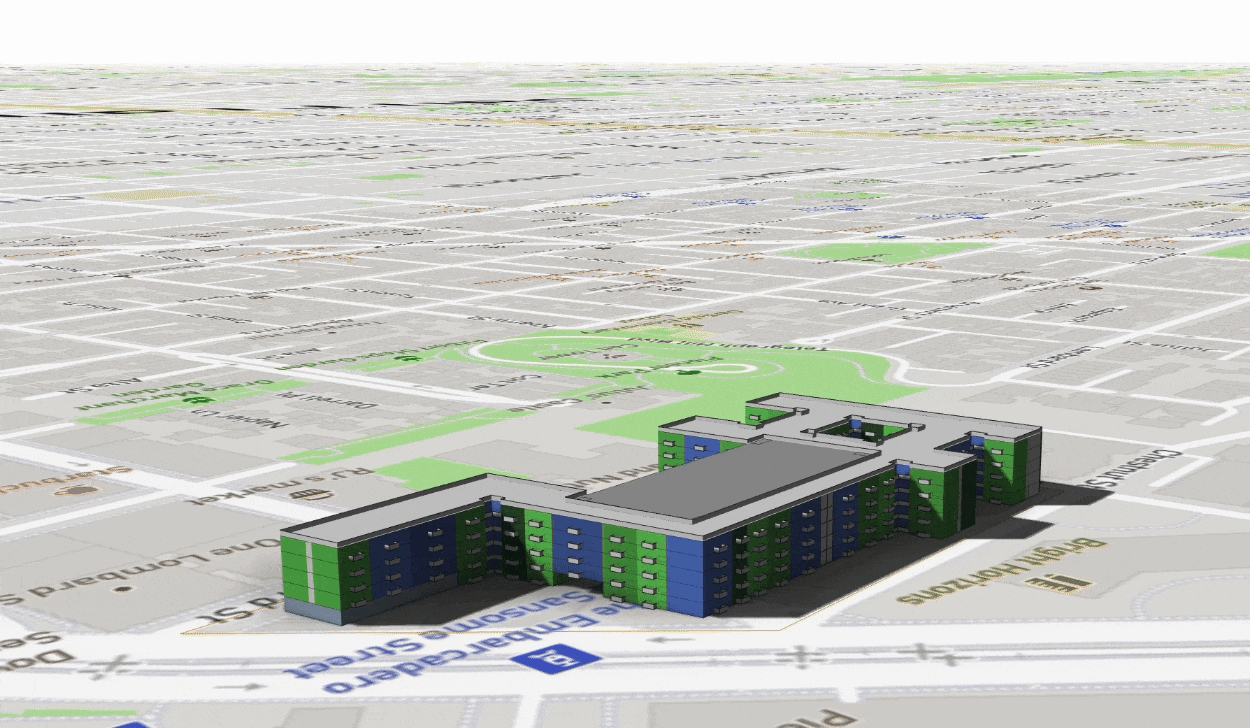
7 - Existing Buildings & Land Use
Finally, we examine existing buildings and land use to capture on-the-ground conditions. This includes documenting on-site structures, their condition, elevation, and use, as well as studying nearby massing and parking treatments. Observing views, focal points, and sightlines helps inform more responsive, context-aware design.
.avif)